.JPG)

.JPG)
.JPG)
.JPG)
.JPG)
.JPG)
.JPG)
.JPG)


.JPG)
.JPG)

.JPG)
.JPG)
.JPG)
.JPG)
.JPG)
.JPG)
.JPG)
.JPG)
.JPG)
.JPG)
.JPG)
.JPG)
.JPG)
.JPG)
.JPG)
.JPG)

.JPG)
.JPG)
.JPG)
.JPG)
.JPG)
.JPG)
.JPG)
.JPG)
.JPG)

.JPG)
.JPG)
.JPG)
This morning we loaded a bunch of caches into the GPS and off we went with Muffy and Raggs. Our first stop was the Metairie Cemetery again to finish off the other 5 caches there. None of them were anything other than NRV caches and you have read the history of this cemetery 3 or 4 days ago.
Next was a cache located at the first drive in in the metropolitan New Orleans area which started operation May 28, 1940. It covered 250,000 square feet and could accommodate 500 automobiles. The theater opened at 7:00pm Tuesday showing two shows nightly. The first feature was "Golden Boy" starring William Holden and Barbara Stanwyck. Admission for adults was 25 cents and 10 cents for children.For many years it was the only drive in in the area. The newspaper advertisement identified it simply as the "Drive In". Then it was another NRV cache near a shopping center at the high water mark of Katrina which was over my head.
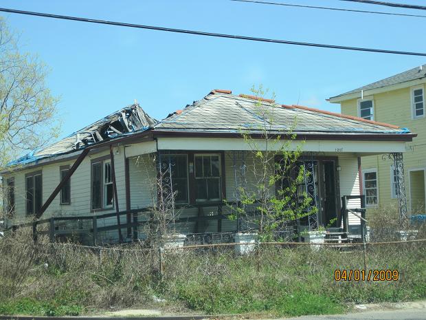
Then we did an Earthcache relating to Hurricane Katrina and the breaching of the levees in the city. Hurricane Katrina struck the birds foot of the Mississippi the morning of August 29, 2005 near Buras La. It came ashore with wind speeds of 125 miles per hour, making it a category 3. Luckily, the winds diminished from category 5 strength only 24 hours earlier. Storm surge in the gulf was 18-23 feet which topped the levees in St Bernard Parish. Within the New Orleans city limits neither the river levee nor the lake levees were breached during the storm. There was major topping of the lake levee in Eastern New Orleans, and a smaller amount north and west of the city. None of the drainage canals in the interior of New Orleans were "officially" topped, but the levee breaches and overtopping of the Industrial Canal and lake levee allowed the water to inundate the city. In all 85% of the city was flooded as a result of the levee failures and overtopping. When the city of New Orleans was originally founded in 1718 by the French Mississippi Company, the land around Lake Pontchartrain was swamp. As the population grew, the swamp was drained and houses were built on a thin layer of dirt placed on top on the swamp deposits. Before colonization, over the previous several hundred years layers of peat and swamp deposits built up. These swamp deposits are not stable and can break apart easily. Water in the canals placed tremendous outward pressure on the levees. This outward force caused the peat and swamp deposits to become unstable and act as a fault plane. This fault or (glide plane) allowed a 200+ ft section of the levee to be displaced laterally about 45 ft ( figures 2 and 3 ). Normally, the Swamp deposits are between 8 to 15 feet underground but due to the horizontal faulting of the ground, these peat and swamp deposits were "heaved" or pushed up to the surface. Before the debris was removed from the Lake View neighborhood, large blocks of the peat were seen sitting on the surface. There were also several reports from people who lived next to the levee of water seeping into their back yard months, even years before the breach. These seeps could have been a clue that water was making its way under the sheet piling used to stabilize the ground under the levees. Nothing was done about these water seeps. The possible explanation of how the 17th street levee failed. An eye witness said that the levee wall started to lean at 6:30 in the morning even before the storm passed the city. This could have caused water to come in contact with a weak peat layer running under the sheet piling. Some combination of the water soaked peat and the outward pressure on the levee caused a 200+ ft section of the levee to be displaced laterally 45 feet between 8:30 and 9:00 in the morning. View of the 17’th street canal looking to the south. Notice the portion of the levee that was pushed out of place during the breach. Notice the trees growing on the levee. Tree roots would provide stability to the soil, but during a large storm, the ground could become saturated with water. The wind can push over the trees which would tear out large sections of ground ( or the levee ). Most of the trees on all the levees around the city have since been removed. In most places around the city, the drainage canals that flow directly into Lake Pontchartrain have an I-wall on top on them. This I-Wall provides an additional 3 to 6 feet of flood protection to the City. Notice what the I-wall does here at this location. The water was a couple of feet over the top of the dirt levee where it breached in the 17’th street Canal. The I-wall kept most of the water over the dirt levee out of the city (except where it breached). The water was also several inches to a foot over the top of the dirt levee here on the Orleans canal (our Mystery breach). Can you come to any reasonable conclusion as to why the flood protection wall does this? It is amazing, but this was designed this way on purpose. Since the I-wall here was designed to do this it is not an "official" topping or breach. I am posting 2 pictures that relates to this paragraph so you can enlarge them and look at them as you read the blog. We got all our necessary information and were off to the next caches.
Our next 8 caches were locatted in The New Orleans City Park. City Park, a 1,300 acre public park in New Orleans, Louisiana, is the 6th-largest and 7th-most-visited urban public park in the United States. Although it is an urban park whose land is owned by the City of New Orleans, it is administered by the City Park Improvement Association, an arm of state government, not by the New Orleans Parks and Parkways Department. City Park is very unusual in that it is a largely self-supporting public park, with most of its annual budget derived from self-generated revenue through user fees and donations. In the wake of the enormous damage inflicted upon the park due to Hurricane Katrina, the Louisiana Department of Culture, Recreation and Tourism began to partially subsidize the park's operations. The facilities are as follows:
Carousel Gardens Amusement Park - features a miniature train, a small roller coaster and several other rides, and one of the few remaining antique, carved wooden carousels in the country. The carousel turned 100 years old in 2006.
Storyland – a children's fairy tale themed playground that features twenty-six larger than life storybook exhibits for kids to climb on, slide down, or pretend within.
New Orleans Botanical Garden – a lush 13-acre site containing a large collection of temperate, tropical, and semitropical plants. The Garden is also home to the New Orleans Historic Train Garden, a G-scale model railroad exhibit with houses representing the various neighborhoods of the city recreated in twigs, bark, and other plant matter.
Celebration in the Oaks – a popular holiday light and entertainment extravaganza that generates 13 percent of the park’s annual operating budget. The event included a two-mile (3 km) driving tour of exhibits placed throughout the park and a separate walking tour of the Botanical Garden, Storyland, and the Amusement Park. As of the 2008 Christmas season, only the walking tour has returned.
New Orleans Museum of Art – originally named the Delgado Museum of Art, the New Orleans Museum of Art is considered one of the finest art museums in the South.
Sidney and Walda Besthoff Sculpture Garden – opened in 2003, the Besthoff Sculpture Garden features over 30 works of world-renowned sculptures in a beautifully landscaped area featuring mature live oak trees.
Weddings & Catering – venues within the park host hundreds of weddings and other functions throughout the year. The park is the largest non-hotel caterer in the city.
Historic Structures – the Peristyle, Popp Bandstand and the Casino Building were constructed between 1907 and 1917. Popp Fountain was added in 1937.
City Park Golf Courses – on the eve of Hurricane Katrina the park boasted three 18-hole golf courses, one of which was once home to the city’s PGA tournament. The courses were damaged by Katrina-induced flooding. One course "The North Course at City Park" reopened in 2008 after undergoing a slight redesign with new greens and tees. The land that contained the former East and West courses are awaiting redevelopment.
City Park Driving Range – a 100-tee, double decker driving range.
Softball and Soccer – the park offers more than a dozen softball and soccer fields.
Tad Gormley Stadium - originally known as City Park Stadium, this multipurpose arena seats 26,500 and was built by the Works Progress Administration. It was renovated for the 1992 US Olympic Track and Field Trials and in July 2005 was home to the Jr. Olympics track and field competitions. After Reggie Bush was drafted by the New Orleans Saints, he donated over $80,000 to repair Katrina-induced damage to the field, so that area high school football teams had a place to compete. In acknowledgement of Bush's generosity, Tad Gormley's playing field is recognized as Reggie Bush Field.
Pan American Stadium - a 5,000 seat stadium, host to many high school football games as well as numerous soccer matches.
Track – the 400-meter, international track was designed as a practice track for the 1992 US Olympic Track & Field Trials.
Tennis – the City Park Tennis Center, featuring rubico and hard courts, is one of the largest municipal tennis facilities in the South.
Boating and Fishing – the Park features 11 miles (18 km) of lagoons, lakes and bayous stocked with a wide variety of fish, including bass. Boating returned to City Park in 2009. Fishing is allowed seasonally. The park also hosts an annual fishing rodeo - one of the oldest in the nation.
Horse Stables – Equest Farm offers boarding for horses, party accommodation, and equestrian lessons. The park has also historically housed the New Orleans Police Department's stables.
City Park was established in the mid-19th century on land fronting Metairie Road (now City Park Avenue), along the remains of Bayou Metairie, a former distributary of the Mississippi River. The park originally extended only a short distance back from City Park Avenue, as swampland covered most of the landscape between Bayou Metairie and the south shore of Lake Pontchartrain. This area, to the north of the original park, was actually platted for streets by city planners, though none were ever realized.
In the first two decades of the 20th century, numerous improvements were undertaken by the City Park Improvement Association. Notable park landmarks like the Casino, the Peristyle, Popp Bandstand, Lelong Drive and the Issac Delgado Museum of Art were constructed. City Park's governing board also accomplished a number of large land acquisitions, such that the park assumed its current boundaries. A master plan, by Bennett, Parsons & Frost of Chicago was commissioned to guide the development of the greatly enlarged park; this plan was largely implemented in the 1930s by numerous federal relief agencies, such as the Works Progress Administration.
Substantial improvements were made to the park's newly-acquired land by the WPA, including the installation of many sculptures by WPA artist Enrique Alferez, construction of buildings, bridges, roads, and much of the electrical and plumbing infrastructure that were still serving the park when Hurricane Katrina struck in 2005. A formal rose garden was developed, the genesis of today's New Orleans Botanical Garden. The WPA also planted Couterie Forest and constructed Popp Fountain, City Park Stadium, a second 18-hole golf course - home for many years to the New Orleans Open golf tournament - and a golf clubhouse, which was later partially demolished to accommodate I-610.
After World War II, two additional 18-hole golf courses were added, I-610 was constructed through the park, a new golf clubhouse was erected, the Wisner Foundation subsidized the development of a scenic parkway running almost the entire length of Bayou St. John (Wisner Boulevard), and multiple rounds of expansion and improvement occurred involving various park facilities. By the 1970s, City Park featured four 18-hole golf courses, over 50 tennis courts, numerous other athletic fields and facilities, and the newly-expanded New Orleans Museum of Art. However, as was the case with many urban parks during this period, City Park began to suffer neglect, the result of insufficient maintenance due to budget cuts. Towards the end of this period the Friends of City Park was formed to rally support and raise resources for the park.
Hurricane Katrina did extensive damage to the park, with winds toppling an estimated 1,000 trees and damaging many more. The subsequent failure of multiple floodwalls brought about the inundation of much of the city, and almost the entire park was flooded with 1 foot to 10 feet of water that remained for two to four weeks, damaging all buildings, amusement rides, maintenance equipment, electrical systems and vehicles, and causing the death of more trees and landscaping - including nearly the entire plant collection in the New Orleans Botanical Garden.
The first 7 of our caches were really NRV caches but it did bring us to 7 of the above beautiful locations in the park. Our last cache was an Earthcache located near a bayou in the park. This bayou along the Southern edge of City Park is all that remains of the central portion of an ancient Mississippi River flood channel. This bayou originally began near Kenner, Louisiana, meandered its way eastward across the entire New Orleans area, and ended south of Irish Bayou. Its segments were named Bayou Metairie in the West, Bayou Gentilly in the middle, and Bayou Sauvage in the East. The bayous conferred their names to the banks, or ridges, which Native Americans and settlers used as paths, and eventually roads. Bayou Metairie gave us Metairie Ridge which became present day Metairie Road. Bayou Gentilly, became Gentilly Ridge and finally Gentilly Road and Chef Menteur Highway. The eastern remains of the channel, Bayou Sauvage, are still in existence where Chef Menteur meets Highway 11.
The purpose of the cache is to understand the geologic processes which formed the ridge and its impact on the geography and development of the area.
The Mississippi River is the dominating geologic feature in Southeast Louisiana. It was the river after all which created Southeast Louisiana. Draining 41% of the continental United States, including 31 states and two Canadian provinces, more than 400,000 tons of sediment are carried by the river every day. While the river's course is currently being constrained by the hand of man, it was certainly not always so. The sediment laden river has been overflowing its banks and even changing course over the past 5,000 years. Through which it laid down the land that would eventually become New Orleans. To put the creation of this region into perspective, it was only 4,800 years ago that the first pyramid was built for King Djoser of Egypt. In Geologic terms, New Orleans rests on some of the newest real estate on the planet.
Over those past 5,000 years, seven major deltas were formed by the Mississippi River. With each change in course, a new location would receive the sedimentary deposits carried down from the upper continent. From 4,500 to 3,500 years ago, the Cocodrie Delta began laying the groundwork (literally), for the land beneath New Orleans and the ridges across the floodplains. Over time, other deltas would come to complete the work. When the river wasn't changing its course the surrounding areas were subject to periodic flooding. Mirroring the sedimentary work of the parent river, the flood waters carried sediments into the surrounding swamps forming meandering distributaries with their own, smaller, river banks.
When early French explorers came to the area, the local natives revealed the banks, or ridges, as the paths they used to traverse the swamps. Bayou Road (the oldest road in the New Orleans area) lies on one such ridge. Its ridge, Esplanade Ridge, runs from the river and intersects with Metairie Ridge and Gentilly Ridge at Bayou St. John. When New Orleans was founded in 1718 by Jean Baptiste Le Moyne, sieur de Bienville, he chose the point where Esplanade ridge meets with the river's natural levee.
Backtracking just a bit, it was in 1670, that René-Robert Cavelier, Sieur de La Salle explored the upper continent and sailed down the Mississippi River to discover its link to the Gulf of Mexico. LaSalle claimed the river and all the land which it drained in the name of France. La Salle returned to France and made the case for the establishment of a fortification and colony on the Mississippi River near the Gulf of Mexico. He reasoned that a military fortification would not only protect France’s claim on the land, but would provide for a safe harbor from which they could harass both the Spanish and British fleets in the Gulf. While LaSalle's return to the region in 1684 was an ill-fated voyage, a subsequent voyage by Pierre le Moyne, sieur d' Iberville and his brother, Bienville, in 1698 had much better luck. Ibverville and Bienville found their way along the Gulf Coast to Lake Ponchartrain and south into Bayou St. John. Led by the local natives, they were shown the way to the Mississippi via the Esplanade Ridge.
While the city could have been located up or down the river from its chosen site, the ridges of the area helped in the selection process. The French needed to protect their claim on the watershed of the Mississippi River. LaSalle's plan called for a fortification on the river. The fortification site would thus need a support colony and lands on which to settle that colony. The wide natural levees of the Mississippi and the banks of its distributaries offered that needed land. To support the colony, it was realized that trade with the city itself would be best served through a shortcut through Lake Ponchartrain, Bayou St. John and down the Esplanade Ridge. Having trade with the city itself move through Lake Ponchartrain rather than the much longer route down the river to the Gulf would be beneficial to the local economy.
Lands along Bayou Metairie and Bayou Gentilly were awarded to colonists to help develop the region. One such development was the Allard Plantation, significant in that its land would eventually become the plot for City Park, the location of this cache. Commerce between the city and the agricultural developments and areas outside the city would be facilitated by the ridges. Plantation products and supplies would move in and out of the swamps via the ridge roads.
As the City of New Orleans grew, so too did its conflict with the local environment. Drainage of sewerage and rainwater was (and still is) the chief environmental problem which faced the growing city. Early plagues of yellow fever would eventually be tied to mosquitoes and poor drainage, for instance. The need for cemeteries was such that early on, inner city cemeteries would fill and be closed. Locals and tourists note our abundance of above ground crypts. Mistakenly, this is attributed to the city's elevation. It is more a result of the city's Caribbean/Spanish heritage. Such burials are typically too expensive for the remains of the city's poor and indigent dead. Burying the poor required the less expensive method of burial in the ground. Burying anyone in the ground in New Orleans requires well drained soil. Metairie Ridge offered the needed solution.
The ridge once marked the northernmost developed land in the city. The land beyond the ridge towards Lake Ponchartrain was considered unusable swamp. It was preferred that the indigent dead would not be buried within the city. As Metairie Ridge was on the outskirts of the city on well drained soil it would be chosen as the site for a new pauper's cemetery. In 1879, the Locust Grove Number 1 and 2 cemeteries (on Freret Street) were closed and a new cemetery was opened. Thus we have the second stage of the cache, Holt Cemetery.
Holt Cemetery is presently 5-6 feet above sea level; some of the highest land in the area. Visit "The Holt"The Holt is a good place to bust two myths about New Orleans at once. Yes, we can bury our dead in the ground; and No the city is not completely below sea level. Only 60 or so percent of the city is below mean sea level. Land created near the river, like the French Quarter, and areas along the ridges make up much of the remaining 40 percent. and you'll notice that the dead are still buried in the ground, not interred in above ground crypts. If you're standing as far back as City Park Avenue, it should be easy to see how much higher the ground is.
As the city grew and dealt with its drainage problems, locations north of Metairie Ridge increased in their usefulness and were settled. Bayous Metairie and Gentilly were finally drained and filled in during the early part of the 20th century. The only evidence which remains in the city are the curiously curved roads and this small stretch of bayou along the southern end of City Park. New Orleans is a metropolis claimed from the wilderness in ways unseen in other parts of the country. While it no longer fortifies France's claim on the upper Mississippi Valley, it still operates as a significant port on the Gulf of Mexico; the realization of the potential seen by LaSalle. However, if it were not for the ridges of this area, Bienville would have been forced to pick a location perhaps not as well suited to the needs of his day or of ours. And, perhaps, the development of Louisiana and the Mississippi Valley would not be what we recognize today.
We got the picture and information we needed and then drove to Holt Cemetery. Holt cemetery is one of the only all buried below-ground cemetery in New Orleans. It's primarily for people who can't afford an above-ground tomb. The memorials are homemade and very personal. The many in ground graves are sometimes bordered by wood or pieces of cement with the government headstone in the center.
Founded in 1879, Holt Cemetery is owned and operated by the City of New Orleans. Plots can be obtained for the cost of the burial, with ownership remaining with the family as long as they maintain the plot. As with St.Louis Cemetery No. 2, the pre-hurricane condition of the cemetery made determining the extent of the damage difficult.
Walking among the many hand made headstones, each one is a personal a work art by living relatives of the deceased. Because of limited space, many families re-use ancestral plots at Holt to bury the newly dead. The practice is commonplace in New Orleans’ above ground tombs, where bodies tend to decompose quickly. According to Rob Florence, Holt may be soon closed to future burials—an action that will likely generate heated opposition from those with family ties to the cemetery.
From the flood water and winds of Hurricane Katrina the C&C Technologies map indicates that on August 31, approximately three to four feet of floodwaters covered Holt Cemetery. This information is corroborated by floodlines evident on the tombs and headstones.
We got out and looked around the cemetery and could still see the damage from Katrina which is still very much evident which you can see by the pictures. The cemetery is also supposed to be haunted as the New Orleans ghost tours make this a regular stop. Well are you all read out yet? After this cache we headed back to the coach and made a couple of stops along the way and the it was back for lunch, logs, showers, dinner and bed. So until tomorrow we love and miss you all. Mom & Dad Dori & Dick

1 comment:
Heya¡my very first comment on your site. ,I have been reading your blog for a while and thought I would completely pop in and drop a friendly note. . It is great stuff indeed. I also wanted to ask..is there a way to subscribe to your site via email?
New and Used Catering Equipment
Post a Comment